Home
About
What We Do
Our History
News
Upcoming Events
Partners
Staff and Board
Contact
Projects
Project Overview
Current Projects
Ahead of the Storm
Invasive Species Control
South Chittenden River Watch
Monkton Wildlife Crossing
Public Health
Gallery
Maps
Library
Take Action
Donate
Home
About
What We Do
Our History
News
Upcoming Events
Partners
Staff and Board
Contact
Projects
Project Overview
Current Projects
Ahead of the Storm
Invasive Species Control
South Chittenden River Watch
Monkton Wildlife Crossing
Public Health
Gallery
Maps
Library
Take Action
Donate
Maps
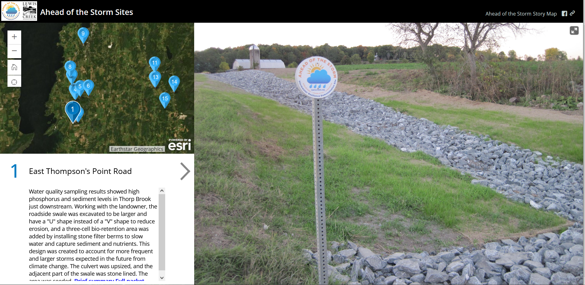
ahead of the storm Story Map
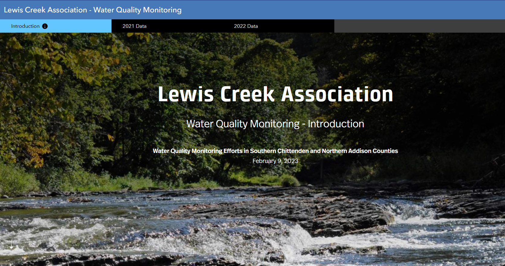
LCA - south chittenden river watch water quality monitoring data story map
(Data from 2021 & after)
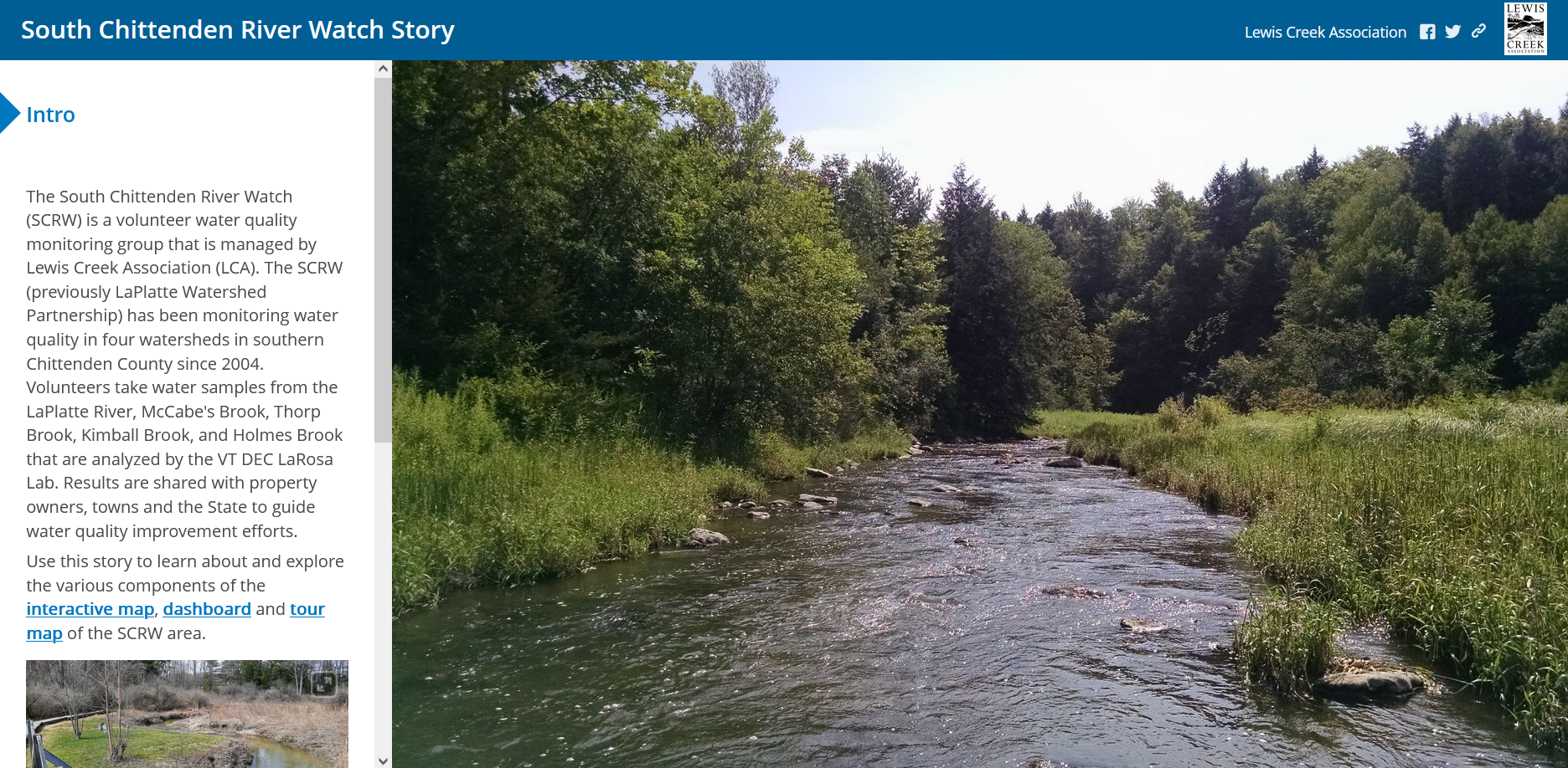
LCA-South Chittenden River Watch Scorecard Map
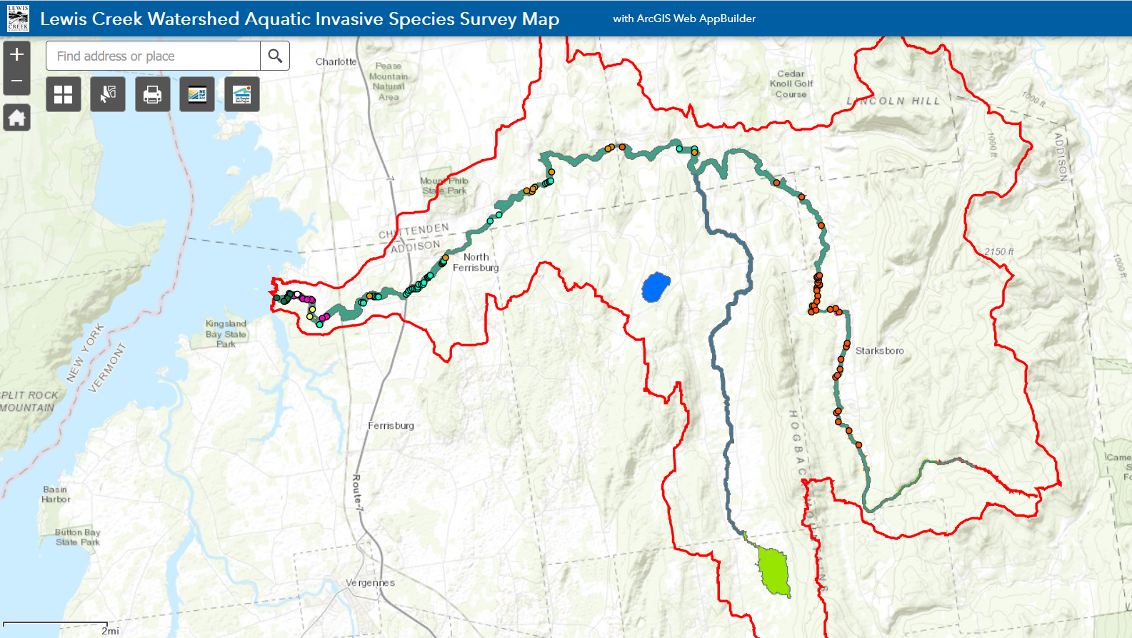
Lewis Creek Aquatic Invasive Species Map
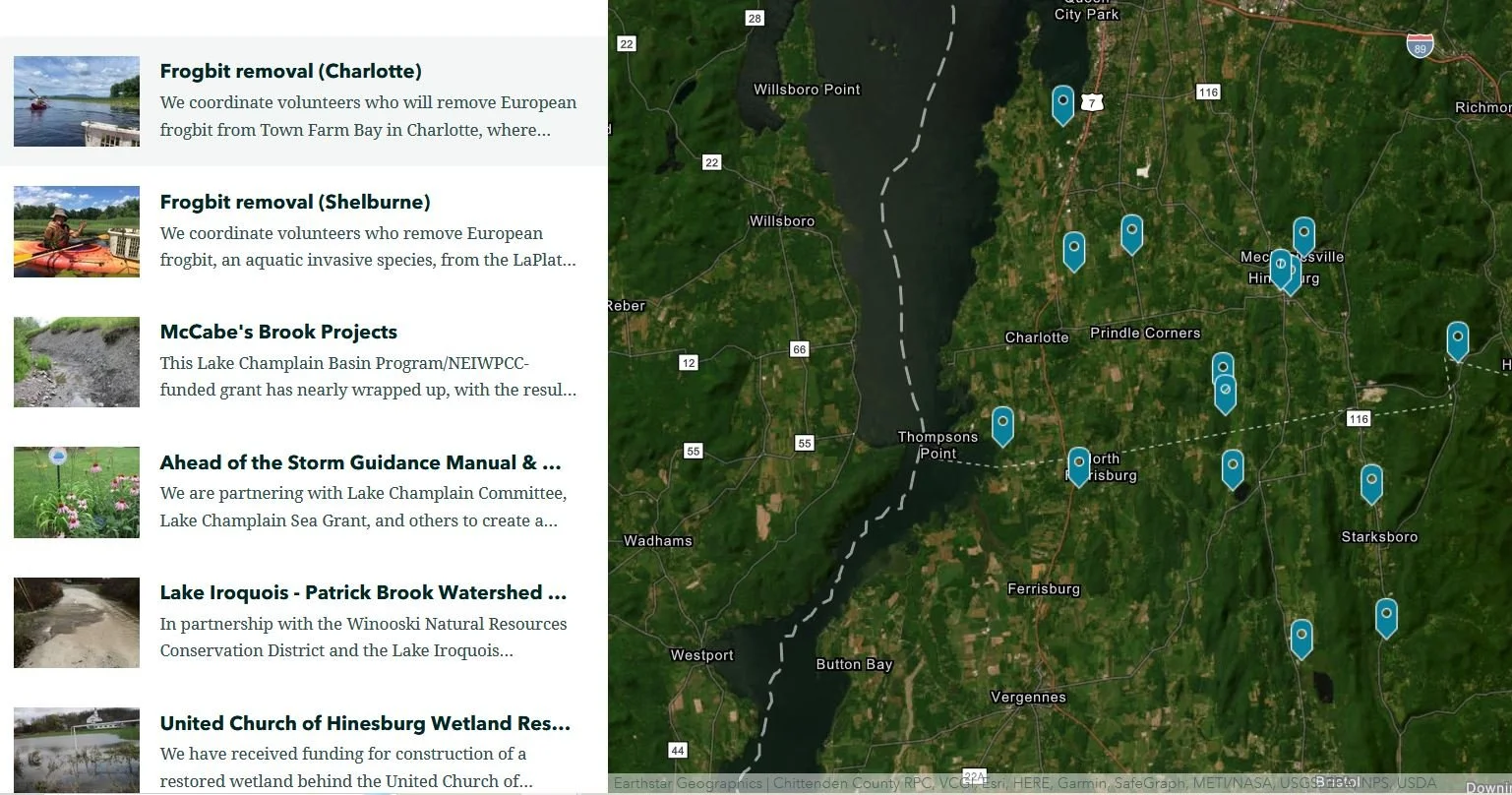
Lca’s Current projects
Static (Non-interactive) Maps
Lake champlain Basin and lewis Creek Association’s Service Area
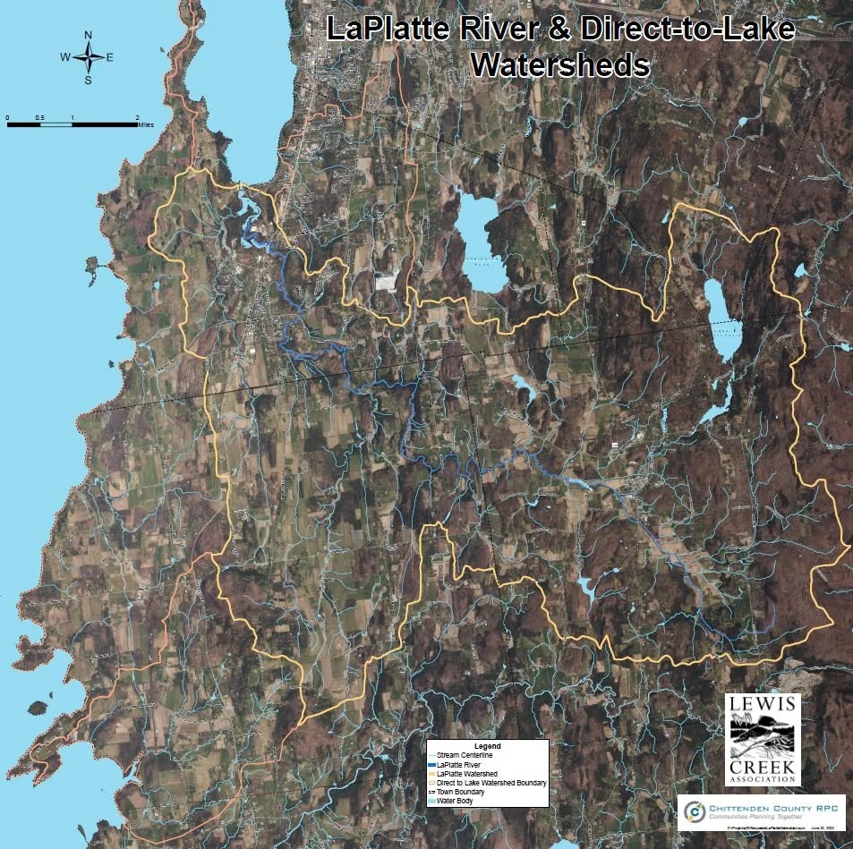
LaPlatte River and Direct-to-Lake Drainages Watershed Map
LaPlatte River Water Quality Scorecard Map
(PDF)
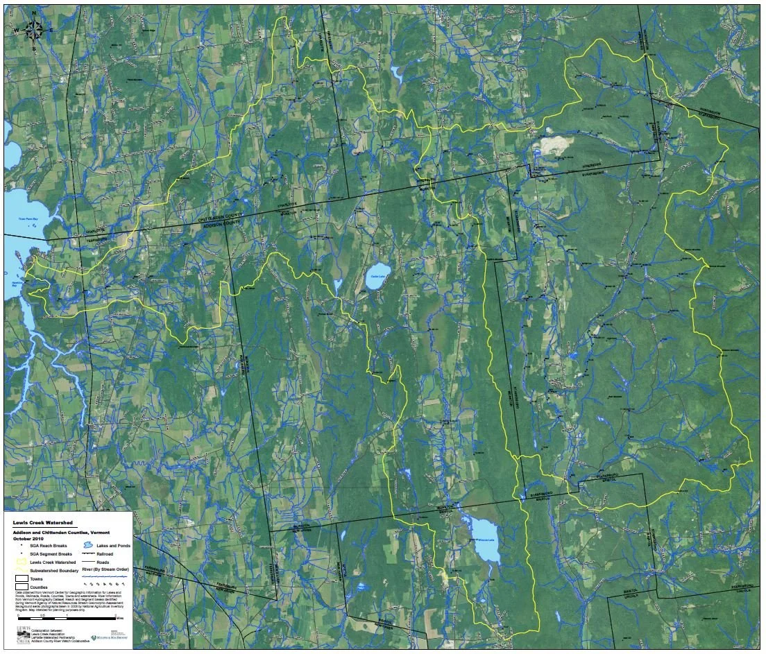
Lewis Creek Watershed Map
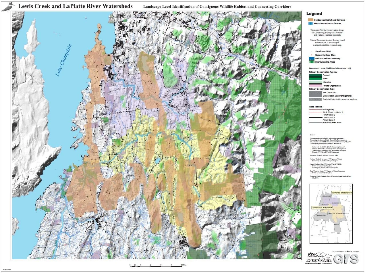
Contiguous Habitat Map
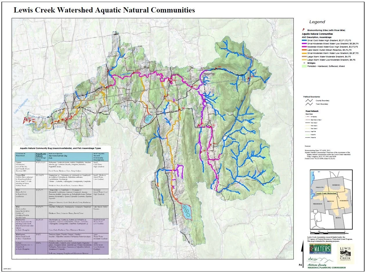
lewis creek watershed aquatic natural communities map
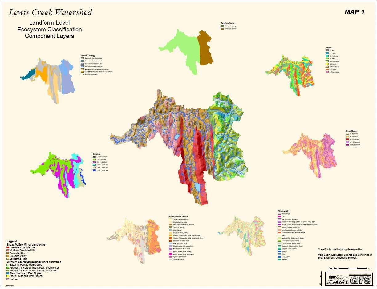
lewis creek watershed ecosystem classification map
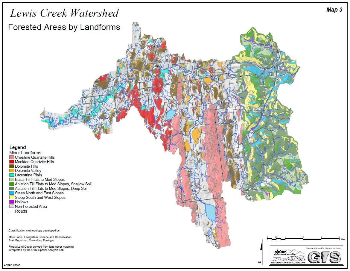
lewis creek watershed forested areas map